


 Stage 3: Path of springs and water
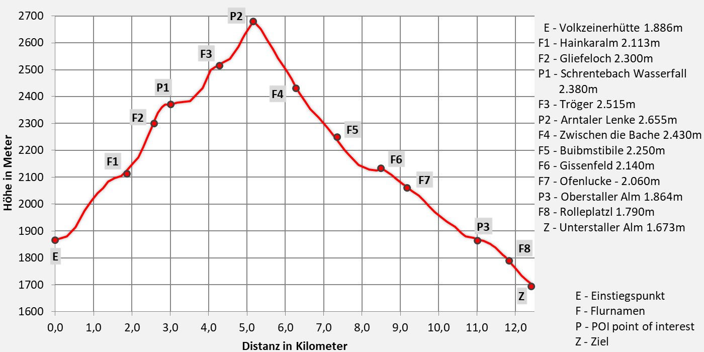
From the Volkzeiner hut to the Unterstalleralm
Walking time 6 hours - moderate hiking
- 12,6km walking distance
- 830 ascent altitude
- 1000 descent altitude
- lowest point: 1673m - Unterstaller Alm (Ziel)
- highest point: 2680m - near Arntaler-Lenke 2655m
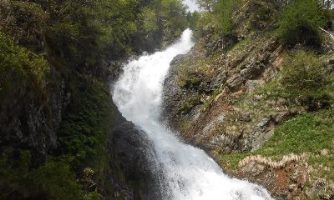
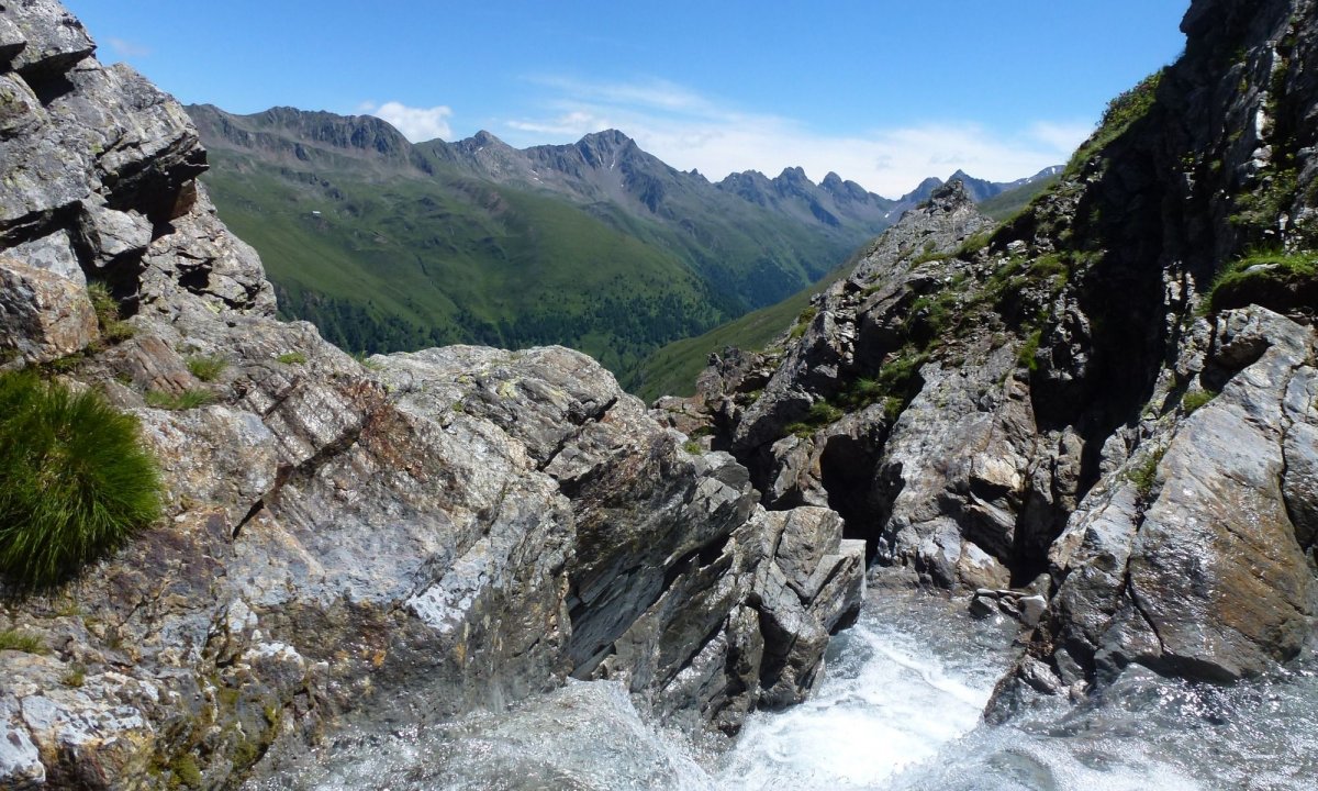
On the way to the water spring
Our first goal on this stage is the legendary Schrentebachboden, an alpine pasture and spring landscape at approx. 2.380 m above sea level, where a roaring mountain stream begins spectacularly. On the way over the Arntaler Lenke you should take a little detour to the fabulous Goldtrögele at 2.630 m and to Degensee (2.720 m). A completely new view opens up at the Lenke, the Dolomites are tentative for the first time and in the north the Großglockner says goodbye to us - path of springs and water.
Directions
Our hike begins at the Volkzeiner Hütte (1.886m). We follow the alpine path to the Raineralm, then on to the Heinkaralm (approx. 2.100m). From here you follow trail no.19 (Tyrolean jubilee path) past the waterfall to the Schrentebachboden (approx. 2.380m) - a wild, mossy meadow between rock and water. From this high-alpine terrace, past the barren remains of a former shepherd's hut, we climb a rocky lawn rib and, keeping slightly to the left, we come to a green carbody with an elongated pool (approx a path branches off to Falkamsee, approx. 20 min, which is always a worthwhile destination and invites you to take a break). Follow trail no. 326 in an easterly direction across a flat trough valley and through countless rivulets and later ascending over rocks to the Arntaler Lenke (Volkzeinerlenke, 2.655m). From here we have a nice look back into the Winkeltal and in front of us is the Arntal, in which we descend, following path no. 326, to the place “Beim Garten”. From there it goes over the alpine path through sparse larch forest and alpine roses (Zetten) directly to the steep rock faces of the almost 3.000 meter high Rotspitze (2.956m) and the Weißspitze, the highest mountain in the Villgrater Joch Hochpustertal (2.962m), the kings of our mountains , along to the worth seeing Almendorf Oberstalleralm. From the pasture we follow the asphalted mountain road down to the Unterstalleralm. With overnight accommodation in the Gutwenger alpine hut. Or you can continue climbing to the Schwarzsee and spend the night in the bivouac hut.
Trump card variant:
- additional ascent Großen Degenhorn 2946m
- difficult hiking 8 hours
- 12,4km walking distance
- 1075 ascent altitude
- 1250 descent altitude
- lowest point: 1673m - Unterstaller Alm (endpoint)
- highest point: 2946m - Großes Degenhorn


Contact details snack station Unterstalleralm:
no overnight accommodation
Tel.: +39 348 3969799
Email: This email address is being protected from spambots. You need JavaScript enabled to view it.
Internet: blog.osttirol.com/reisetipps/unterstaller-alm