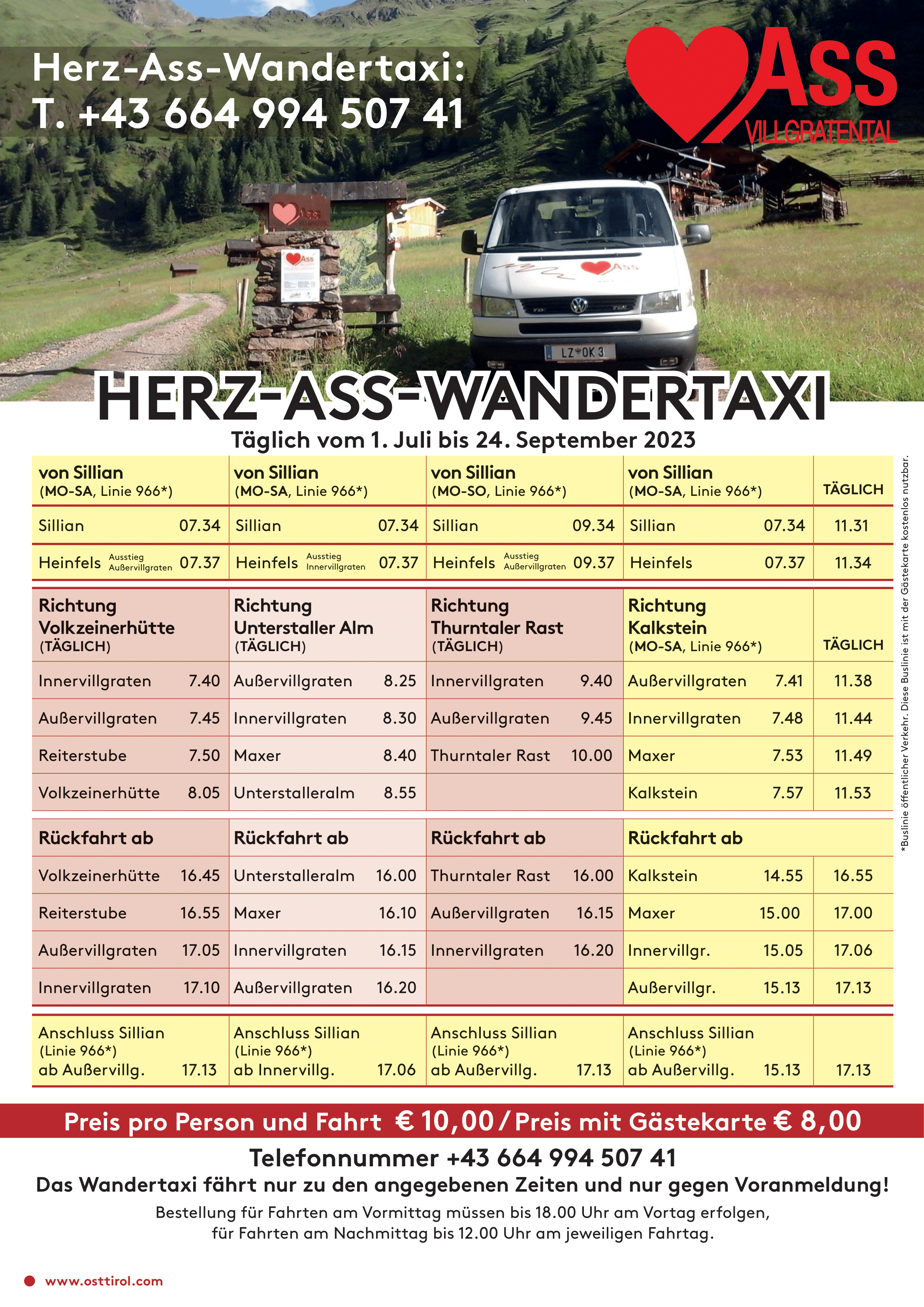
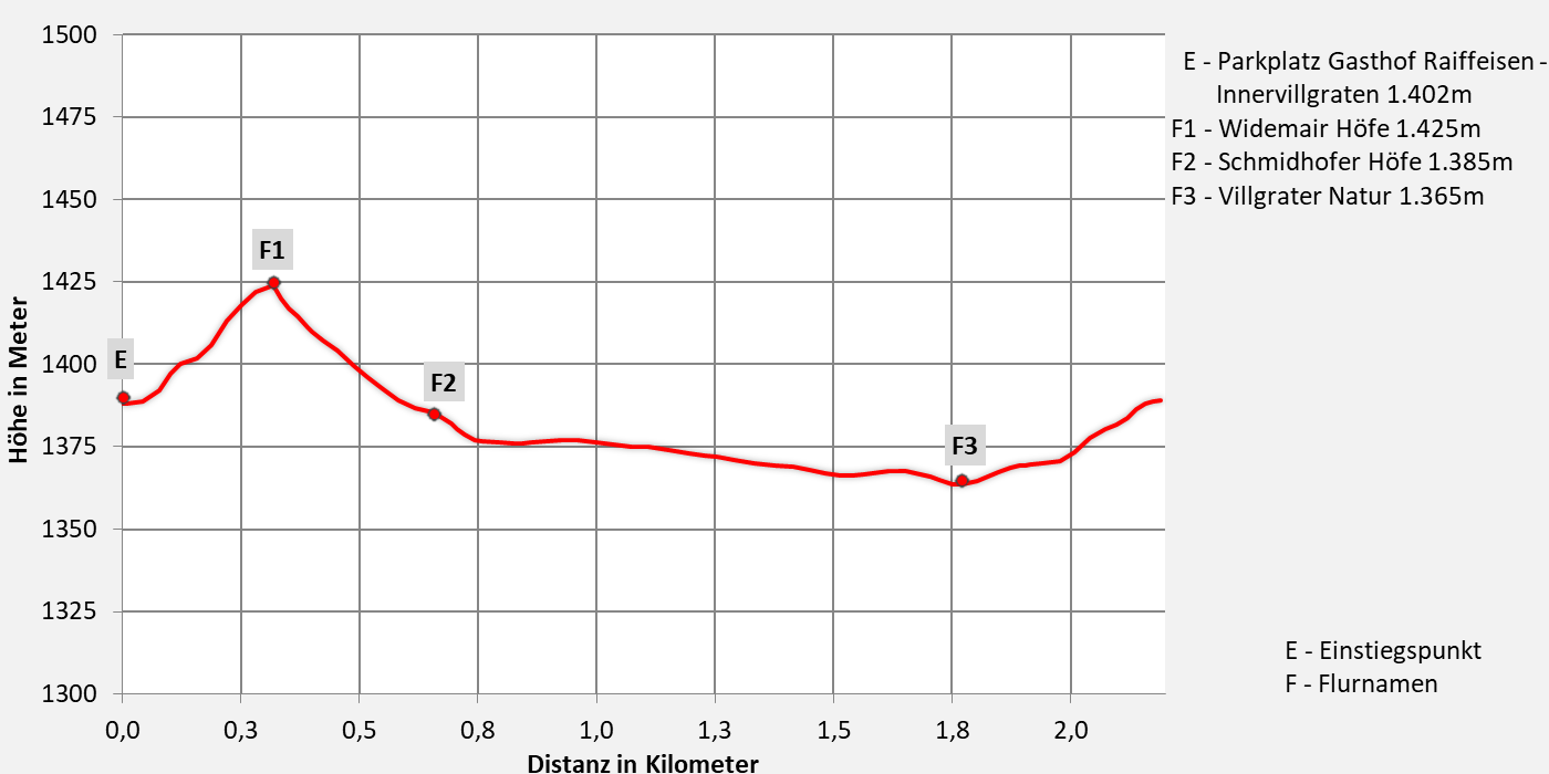
Trail "Unter" village view path of Herz-Ass Villgratental
Village view path to get to know from the village center in Innervillgraten
Walking time about 1 hours - easy hike
- 2,2km walking distance
- 45 ascent altitude
- 45 descent altitude
- lowest point: 1.365m - Villgrater Natur
- highest point: 1.425m - Wiedemair Höfe
Innervillgraten alley route
The starting point is the Gasthof Raiffeisen car park. We walk past the tourist office in the direction of Einathtal, after 250 m we turn left at the "Wiedemair Höfe" and between the centuries-old stone walls we enjoy the view of the parish church Innervillgraten. From the "Schmidhofer Höfen" we cross the L273 as well as the Villgrater Bach and turn left there and walk between Talbach and the Prantersiedlung out of the valley. We walk along the waterway to Villgrater Natur and cross the Villgrater Bach on the left. Past the building yard and the fire station, we now cross Landestraße L273 and the Einathtalbach again, where we then walk parallel to Schmiede Steidl or Gasthof Raiffeisen. At the Steidl smithy we turn left and come back to the starting point.